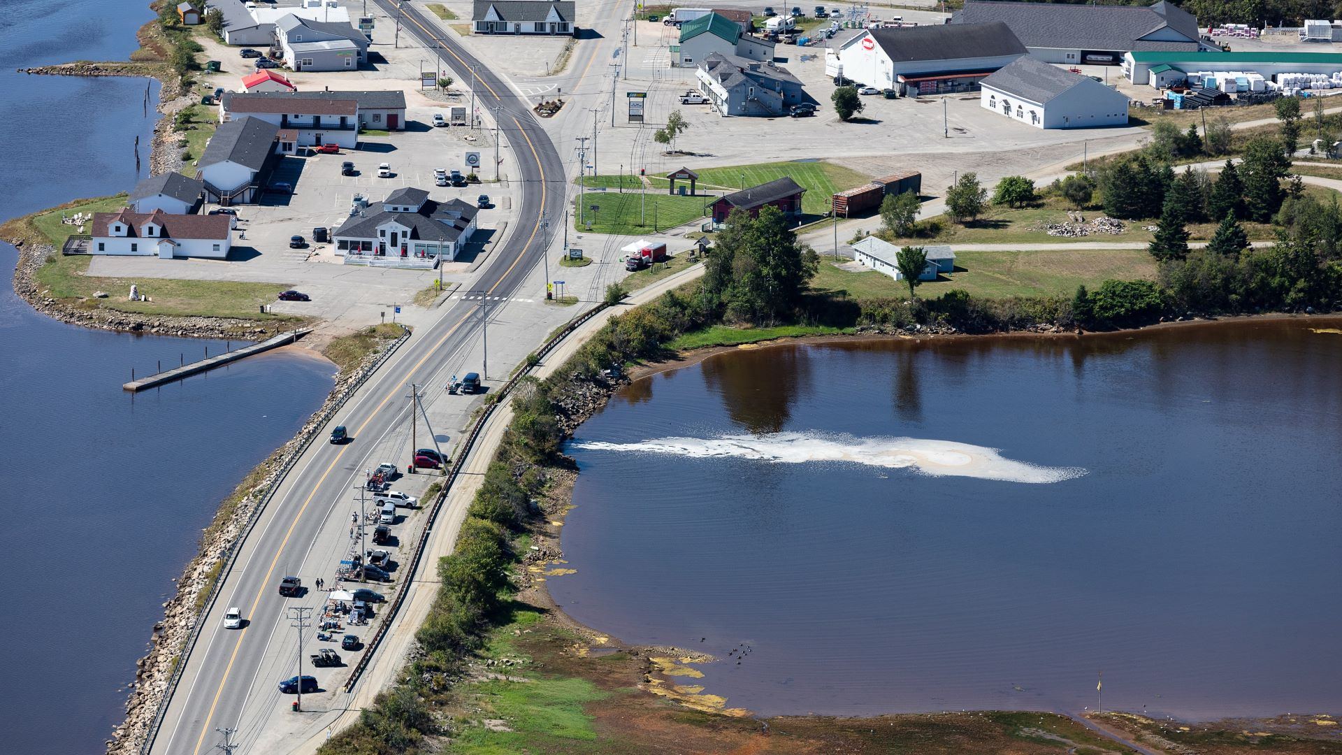
The Maine Department of Transportation (MaineDOT) announced Tuesday it is immediately closing portions of the Machias dike on Route 1 due to “increasing voids” found under the road surface during a recent inspection.
According to a MaineDOT press release, part of the shoulder and parking area on the southbound (upstream) side of the bridge are closed as of Tuesday, Nov. 7, though Route 1 traffic will continue over the span for now.
Ten pylons were placed around a portion of the dike, encompassing about half of the dike parking area frequently used by vendors. MaineDOT public information officer Paul Merrill said additional safety measures will be taken as needed.
“Our bridge engineers will post weight restrictions or close a road or bridge before it gets to the point where it is unsafe to use,” Merrill said in a statement to The Maine Monitor.
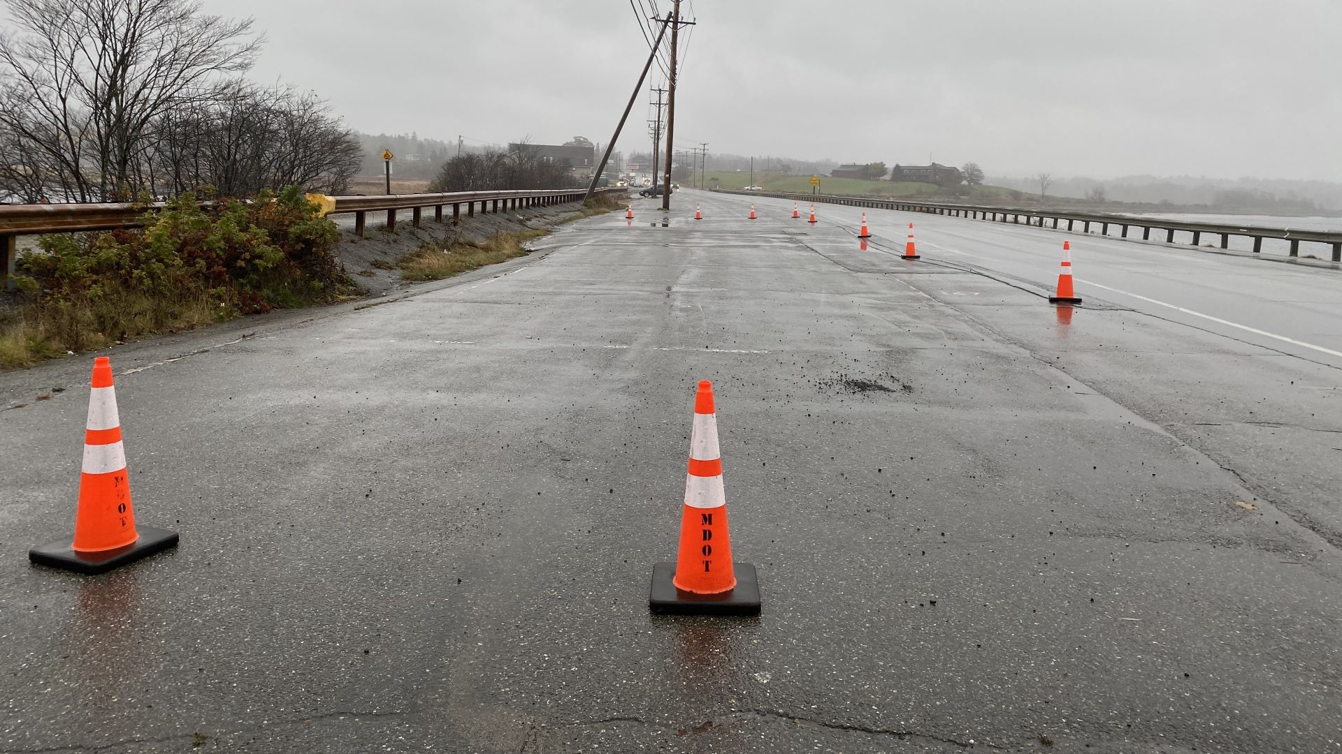
The sudden move comes after bridge inspectors observed areas of concern during a routine bridge inspection in September and worsening conditions when divers re-inspected the area last week.
Divers observed new areas of soil loss between the concrete slab (under the road surface) and the timber that forms the top of the gated boxes, according to the press release.
As an emergency stop-gap measure, MaineDOT officials will construct a temporary bridge over the existing structure to maintain traffic flow and the use of the adjacent Sunrise Trail. Work on the temporary bridge is expected to begin sometime “in the coming months,” although no specific timetable was yet available.
Once construction begins, Route 1 will be closed for approximately a week, the release said. Further details about Route 1 were not available Tuesday.
The MaineDot also announced Tuesday it has reversed its decision regarding its preferred alternative for a permanent dike solution. After initially favoring replacement of the dike with a permanent bridge span, MaineDOT’s new preferred alternative involves the continued use of fully gated culverts.
“While MaineDOT realizes that some stakeholders may prefer a bridge alternative and tidal restoration, the department believes a fully gated culvert alternative will best meet the project’s purpose and need,” according to the press release.
MaineDOT further stated that this alternative will improve the structure’s condition, maintain the Sunrise Trail, provide for future rail use, and avoid flooding hundreds of acres of land along Middle River. No additional details were available yet about what kind of improvements are planned, or if this would be a replacement structure.
The need to erect a temporary bridge — and the MaineDOT’s about-face regarding its preferred permanent plan — comes after years of debate and analysis by MaineDOT, Maine DEP, and federal authorities, over the best way to mitigate problems with the Civil War era dike.
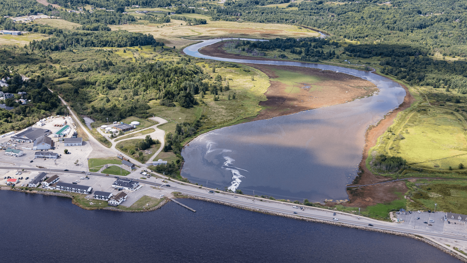
In addition to concerns over deterioration of the dike, a permanent solution is also needed to address increased flooding that often washes over the dike, and heightened concerns about possible flooding downtown as sea levels continue to rise.
Environmental groups favor a bridge span that would provide better fish passage and tidal restoration. In 2018, federal officials voiced similar concerns, subsequently leading MaineDOT last year to announce that a bridge span was its preferred choice as well.
No details were available yet about why the MaineDOT reversed its decision about its initially preferred plan for a permanent bridge, or the scope or cost of work for its new preferred plan, the continued use of fully gated culverts.
According to the press release, MaineDOT will prepare a draft Environmental Assessment of the gated culvert alternative under the National Environmental Policy Act. The department intends to hold a public meeting on the draft Environmental Assessment in early 2024. This project should be entering the design phase by this time next year.
Additional project information is available on the state’s website.