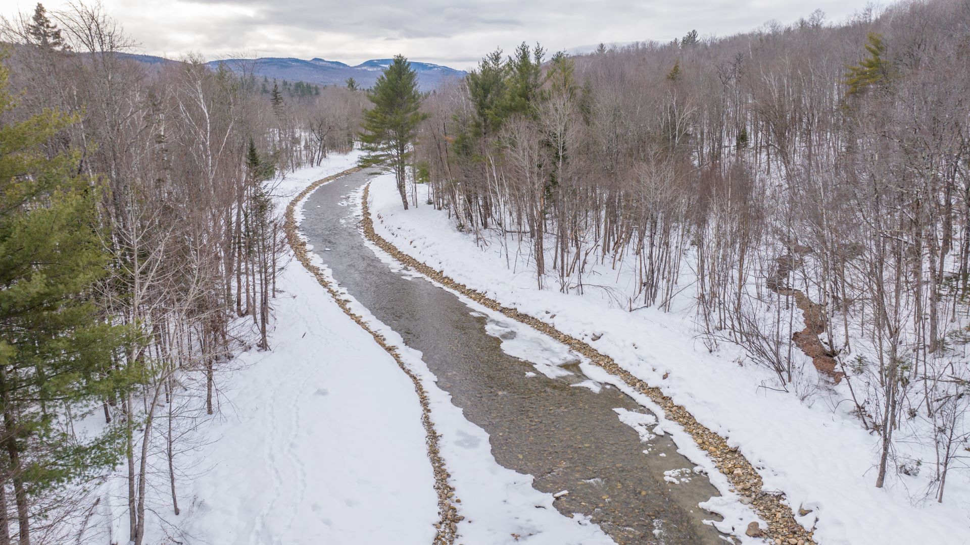
First came the snow. In early December 2023, a powerful storm dropped more than a foot of snow across Maine’s western mountains, with Franklin County recording the highest totals in the state. Ski slopes geared up for a good start to the season; locals broke out their snow blowers and shovels.
Then came the rain. The Kennebec, Androscoggin and Saco rivers swelled, and hundreds of roads closed. The storm killed four people, inflicted more than $20 million in damage across 10 counties and left some areas inaccessible for days. In the mountains of western Maine, the rain hit the snow and rushed down steep slopes toward low ground: the Sandy River Valley.
The devastation was swift in Phillips, a town of roughly 900 people some 15 miles northwest of Farmington. The town’s response, which included dredging part of the river and constructing berms, provoked a notice of violation from the state. Town officials deny they did anything wrong.
A year has passed since the storm, but the debate continues, and a restoration plan is due early next year.
At a meeting in Augusta last month, a geologist hired by the town called the Sandy, and particularly the South Branch, a very dynamic system.
Phillips is no stranger to floods. Nearly 40 years ago, rain and snowmelt combined to form the infamous Flood of ’87, which caused more than $74 million in damage statewide and destroyed roads and washed out culverts in Phillips. The Run Away Pond Catastrophe of 1847 carried away “thriving Bragg Corner,” per the town’s historical society. In 1869, a flood “washed away mills, bridges and homes.” In the past, bank stabilization projects have lasted only a few months.
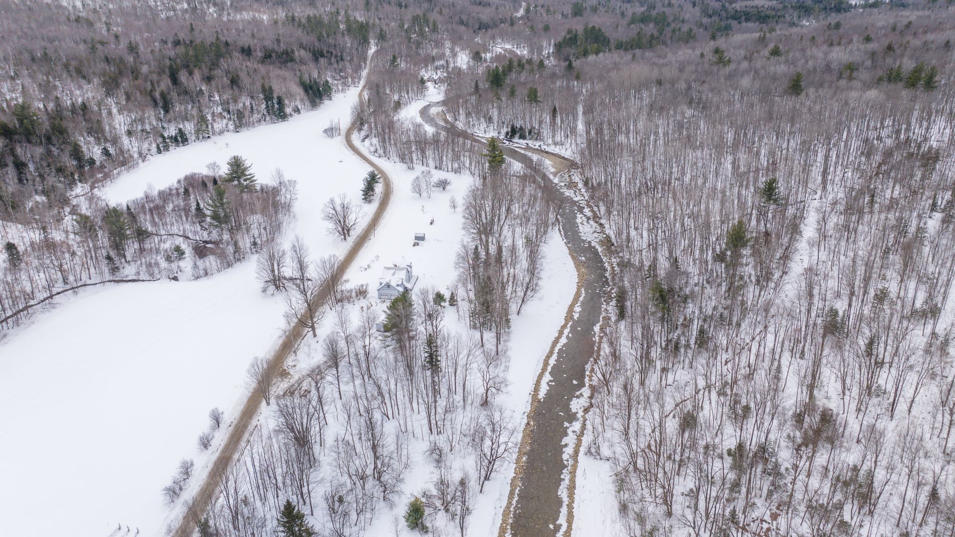
Last December, the South Branch filled up with sediment eroding out of the mountains. As wood, stone and other debris began blocking the flow of water, it sought an easier path: a dirt road that runs alongside the river known as the Number 6 Road.
Diverted and now channeled by the road’s snowbanks, the river dug up the roadway—several feet down and nearly a mile long—and then ran through residents’ yards, driveways and fields. A Central Maine Power utility pole came down. In some “unnerving” cases, as the geologist John Field put it, houses were surrounded by floodwaters.
“It was the river at this point,” Field said. “Basically, the road had turned into the riverbed.”
‘The horror of that water’
Hedy Langdon moved to her house on the Number 6 Road in 1986, a year before she was hired as librarian of the Phillips Public Library. The house was built more than 100 years ago and Langdon has put a great deal of effort into restoring the property, calling it her life’s work.
Langdon recalled several previous floods, including the one in 1987, which severely damaged the road but not her property. The December 2023 flood was different.
“I was home and watched as the river breached its banks and raged down the road,” Langdon said. “The entire property became the river. The field across the road was completely covered by the river. The power went out. The water rose in the basement four feet.”
Langdon anxiously awaited daylight, when the water receded, leaving behind a gully several feet deep where the road had been. Her home was an island. The gardens had washed away. She was heartbroken.
Town officials in Phillips now had residences at risk, and in some cases entirely cut off from emergency services, on top of other washed out roads. Unable to get answers from state officials directly during the multi-day disaster — a problem that was not unique to Phillips — town manager Maureen Haley contacted Rep. Mike Soboleski, who went down to the river.
“I can’t imagine the horror of that water coming down through there… those logs… those boulders. The water is there, the road is gone. It was absolutely heartbreaking,” Soboleski said at a meeting in late October.
He called the Maine Department of Environmental Protection commissioner Melanie Loyzim and told her that there were three major blockages in the South Branch of the Sandy. Soboleski received emergency permission for the town to remove the blockages and conveyed that to the town. The town then hired private contractors from three companies.
After the water receded, contractors brought in heavy equipment — excavators, loaders and trucks — and removed the debris blockages and dredged portions of the riverbed.
‘An unreasonable impact’
In April, the DEP received a complaint about the work that had been done along the South Branch. The DEP and other agencies investigated, and on July 12 the department filed a notice of violation alleging that the town had violated the Natural Resources Protection Act.
The town and its contractors “went well beyond the scope of the activities initially described by the Town and authorized to be completed before permitting by the Department,” according to a letter written by Rob Wood, the director of the DEP Bureau of Land Resources.
The notice alleges that contractors dredged and straightened nearly a mile of the South Branch and constructed 15-foot-tall berms in and adjacent to the river.
“Much of the work appears to have taken place after flood waters were receding,” Wood’s letter reads, “with the intent of creating added protection against future flood events rather than alleviating active flooding of the roadway and residences.”
The notice states that the town’s contractors also violated the Erosion and Sedimentation Control Law.
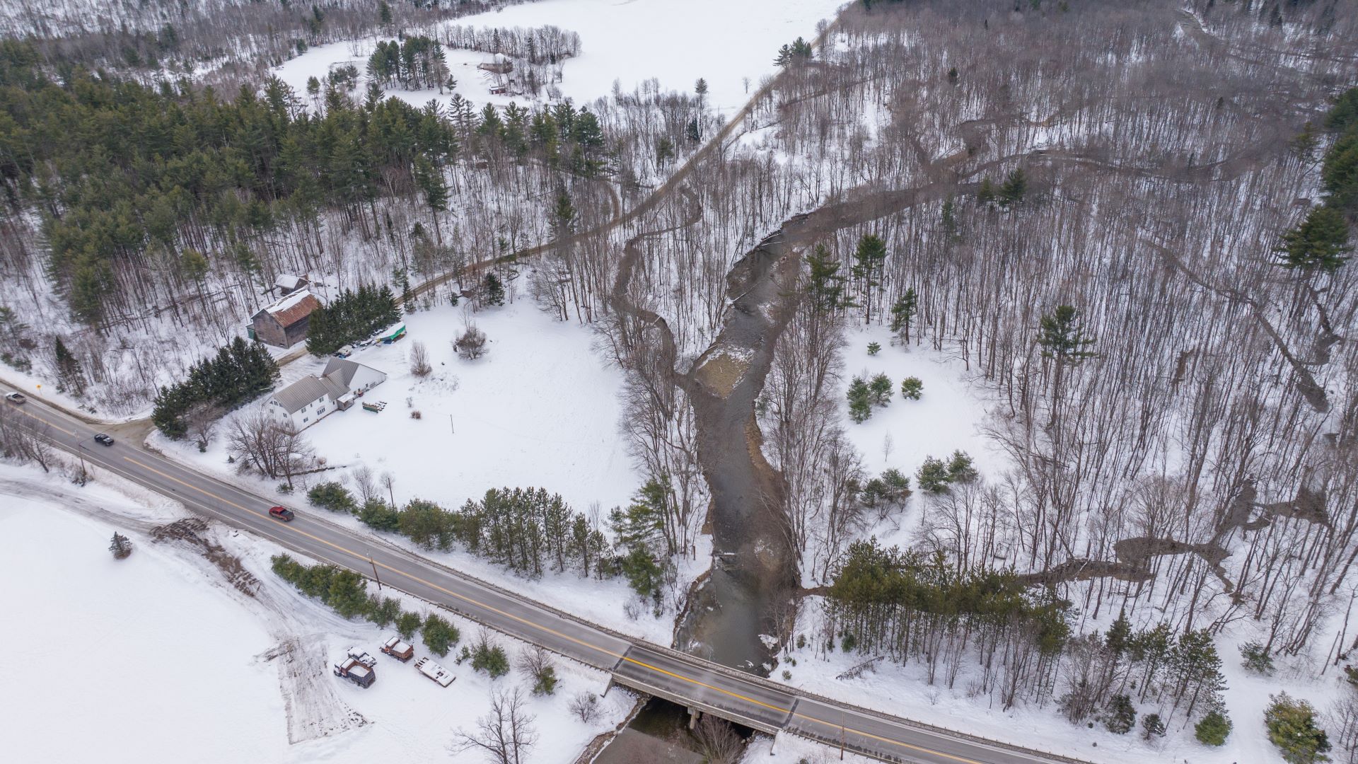
The berms had not been requested and would not have been authorized, Wood wrote. DEP only learned about the existence of the berms on Jan. 12, after receiving a letter and pictures from Haley. At that point, the contractors had completed their work.
“These activities cannot be interpreted to fall within the scope of the NRPA exemption for emergency public works repair … [the town’s activity] has caused an unreasonable impact on the South Branch of the Sandy River and its critical habitat for the federally endangered Atlantic salmon,” the DEP letter reads.
DEP deputy commissioner David Madore declined to respond to questions from The Monitor, saying the agency could not comment on an ongoing investigation.
According to Madore, the DEP isn’t the only agency looking into the matter: U.S. Fish and Wildlife is investigating the impact on the fish and their spawning habitat, while the U.S. Army Corps of Engineers is looking into the dredging. The Environmental Protection Agency is also aware of the violation, he said.
Fish habitat
The Sandy River is considered prime fish habitat, particularly for the endangered Atlantic salmon. The river runs through largely undeveloped forest and is fed by high-elevation sources that provide sufficient cold water to sustain salmon, even in drought conditions, said John Burrows, vice president of U.S. operations for the Atlantic Salmon Federation. The river also boasts gravel beds and braided streams that are ideal for redds, or nests of salmon eggs.
The Atlantic Salmon Federation has been funding a restoration program in the Sandy since 2003, with adult fish sighted in the water since 2006. While dams on the Kennebec block direct ocean access to the Sandy from the south, there are fishways and trucking operations that have allowed for a population of roughly 50 adult fish in the past decade.
The DEP alleged that the town’s work on the river led to the destruction of as many as six salmon redds — a significant number given the overall population. Nearly a mile of the South Branch was transformed from a wide bed with hundreds of feet of braided streams into a bermed channel without trees.
“You basically have very little habitat left,” Burrows said.
The notice of violation required that the town submit a restoration plan to remove the berms and restore the Atlantic salmon and brook trout habitat. The submission timeline is typically 60 days, but the DEP extended the deadline to early next year.
‘What they needed to do’
Town officials deny that they did anything wrong when they sent contractors in to save the road.
“It is always a lot easier to look at things and evaluate them seven months later when the waters have receded and order has been restored,” Haley wrote to the DEP on July 24. “But when you are in the midst of a full-on catastrophic event with limited resources, the perspective is somewhat different.”
Town officials say they were fortunate to find contractors who were available, given the widespread flooding, and that they were focused on preserving lives and property after receiving “discretionary authority” from the DEP commissioner via Soboleski.
“The town did what they needed to do with the emergency declaration,” Haley told The Maine Monitor in an interview last month. “We were facing flooding in winter weather. Emergency services couldn’t access the road.”
Langdon said that she saw contractors start work near her property about four days after the storm. They repaired the breach to redirect the river and filled back in the Number 6 Road.
“It was winter and work decisions had to be made quickly with assurance that there would be access for Number 6 residents,” Langdon said.
The town disputes that their work killed fish or felled trees. Eugene Caton, the vice chair of the Phillips Select Board, recalled seeing raccoons feasting on stranded fish after the floodwaters receded.
Side channels were packed with silt from the storm before the town’s contractors entered the river, Haley said, and any redds not destroyed would have been without water for days and nonviable. Trees were not cut or felled by contractors, town officials maintain, but knocked down by the flood and later moved to sides of the banks.
Officials said that while they were aware that there were Atlantic salmon in the Sandy, they didn’t know the full extent of the restoration program, as signage had not been placed along the river or road. Haley said she only learned about the scope of the program after reading an article on the subject after the flood.
Langdon concurred, noting that although her own property line runs along the South Branch, no one from any agency had ever spoken to her about salmon.
‘This will happen again’
The DEP is now requiring the town to develop a restoration plan for the South Branch. This includes “the re-grading or removal of the dredge spoils/berms in and adjacent to the SB Sandy River and restoration of Atlantic salmon and brook trout habitat in this area.” Effectively, the town needs to recreate the dynamic river system that existed prior to the December flood.
Phillips hired Field Geology Services to come up with the restoration plan. Field has proposed work along four sections of the South Branch: leveling berms and restoring the pre-flood river and then using log and stone structures to reintroduce the side channels. Field is still working on the plan, which is due back to the state by January 15.
The cost of the project and who will pay for it remains to be seen. Phillips has neither the on-hand funds nor a tax base that can support extensive river restoration projects. One possibility may be having the contractors that completed the post-storm work provide labor and materials. Haley is hoping to get some sort of grant, possibly from the Atlantic Salmon Federation, but nothing has been promised.
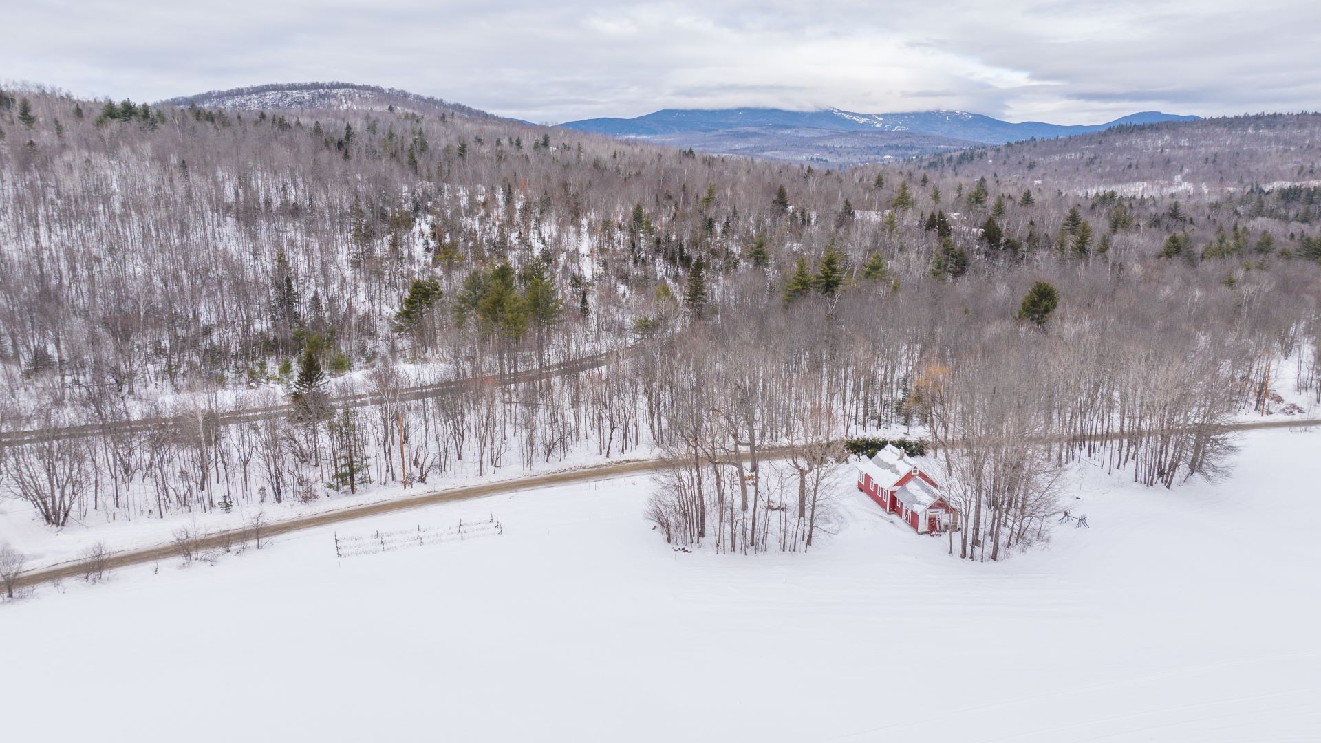
Field’s plan is designed to meet the state’s requirement to restore fish habitat. It does not address the flooding issue for landowners like Langdon along the South Branch, or any of the town’s other 900 residents, many of whom live in the floodplain.
Meanwhile, per the interim report of the state’s Infrastructure Rebuilding and Resilience Commission released last month, Maine is now averaging a storm-related disaster or emergency declaration once a year. Another bad storm could set back efforts to restore the habitat and maintain the road.
“This will happen again,” Field said.
Phillips officials share this perspective. The town is “one storm away from another disaster,” Caton said.
Phillips is working with The Nature Conservancy to analyze the floodplain and generate ideas to make the town more resilient to floods. They are planning to hold listening sessions and conduct community surveys soon.
The future of the Number 6 Road and whether it can continue to be maintained in its current configuration is another question. Haley and Caton both indicated that any decision regarding the road would be made at a town meeting, rather than by the selectmen or town manager.
Langdon, who said that Field had provided a fair assessment of the flood’s consequences and proposed restoration, said that she was concerned about what will eventually be decided for the river and the road.
Any work done along the river can impact its flow and future flooding, she noted, even if it’s intended to benefit fish.
“It is a difficult challenge the agencies, the town, and citizens face in maintaining a balance in an environment of warming trends,” Langdon said.


