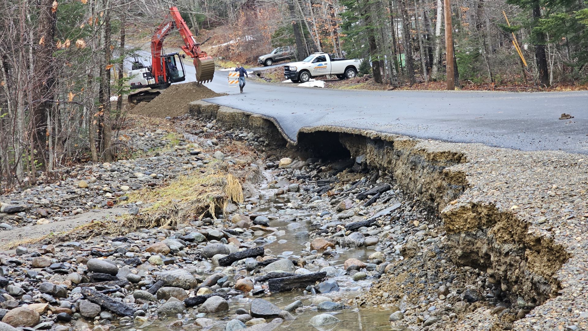
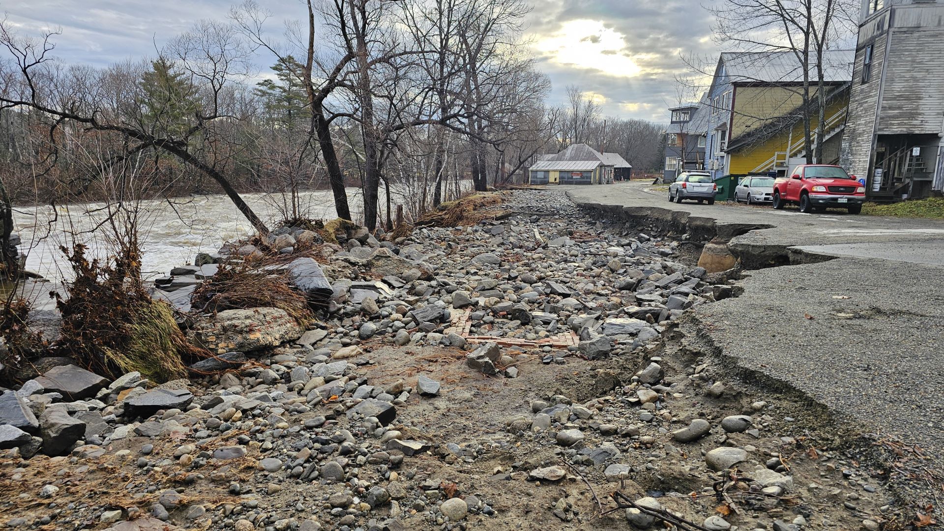
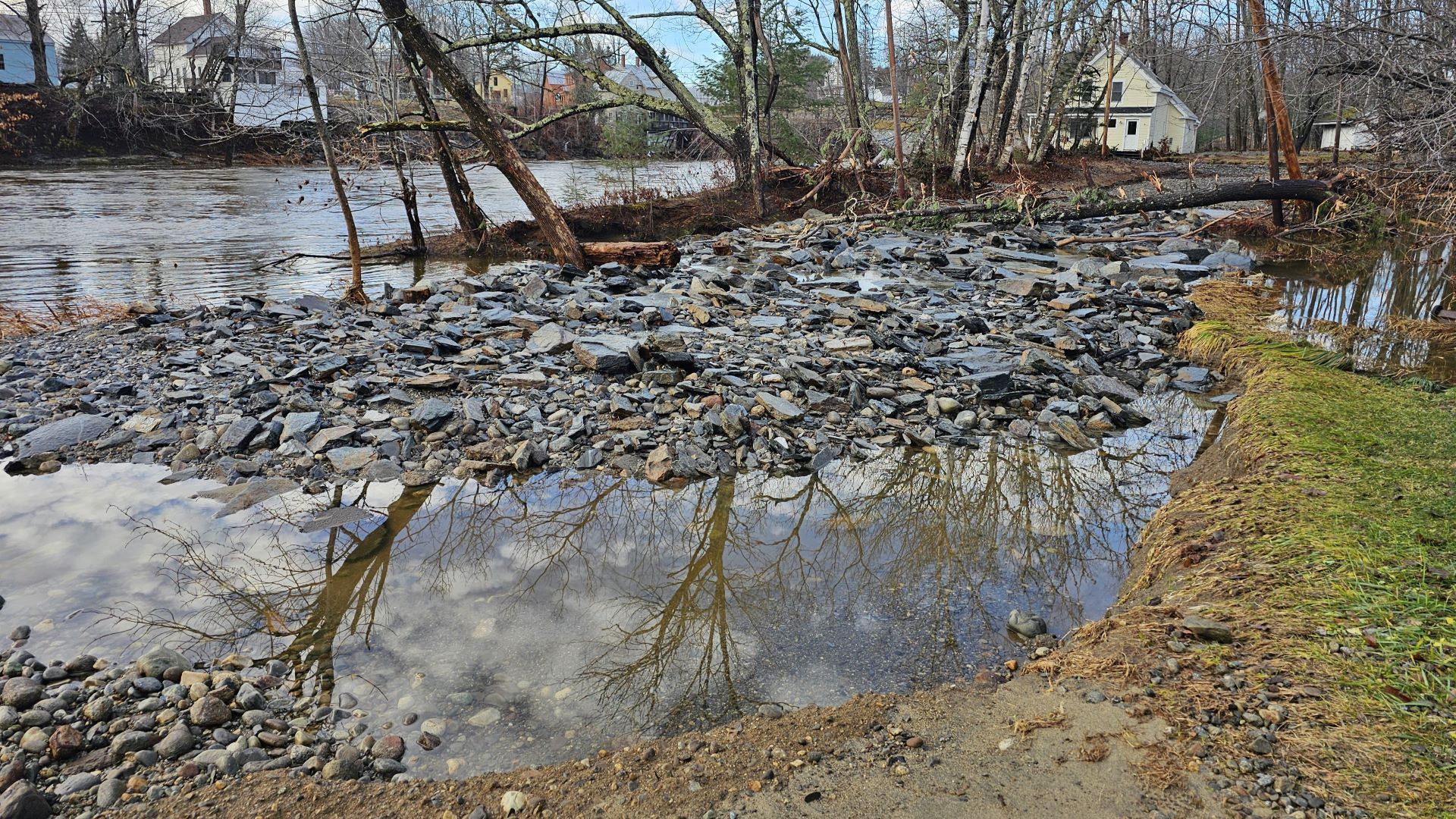
Farmington Town Manager Erica LaCroix was in only her second week on the job when the Sandy River swelled in December, spilling six feet of water in the Intervale area by Main and Front streets, submerging businesses like McDonald’s and Walgreens.
As the river and its tributaries flooded and road closures mounted, LaCroix said Farmington relied on town employees and firefighters to field calls from residents on how to travel around safely.
LaCroix said the sheer speed of the flooding caught her and other officials by surprise, making it even more difficult to disseminate information in real time.
“Locally, we don’t have any real instant notification to the public at all. We don’t have a software, (nor) social media page,” LaCroix said. “We have a website but it’s not updated in real time. So we were pretty much only able to notify people as they called in and said, ‘Is this road passable? Can we get there from here?’ ”
The Franklin County Emergency Agency did host a map of ongoing road closures, but even that wasn’t enough, emergency officials said.
The floodwater’s rapid rise in Franklin County revealed the challenges in notifying residents of road closures and other hazards just as quickly as the water’s movement. Farmington has to prepare for future scenarios where its emergency hubs, like the fire department, are cut off by an overtopped Sandy River.
What’s more, the Franklin County Emergency Management Agency is only staffed by two people: the director, Amanda Simoneau, and deputy director, Sara Bickford. They worked relentlessly on Dec. 18 to update closures on mapping software through Google Maps, but that information can only travel so far when residents lose power or cell service, or don’t use those technologies to begin with, Bickford said.
“It’s just difficult to reach every type of population because not everybody listens to the radio, not everybody’s on social media,” Bickford said. “So finding the best outlet to reach those people is a difficult task.”
On Dec. 18, the day of the storm, Fire Department Chief Tim Hardy was expecting flooding similar to what Farmington saw months earlier, in May 2023, based on reports from the National Weather Service.
But as floodwaters surpassed those May levels and the rain kept coming, Hardy knew an even more disastrous event was underway. Absent an emergency alert system, Farmington police officers and firefighters went door to door, warning businesses they should close and evacuate.
“Those are things we can definitely improve on, because we don’t have that type of (notification system),” Hardy said. “We were using Facebook and … we went door to door.”
Hardy said his department received 110 calls over a 60-hour period during and after the storm, likening the destruction he witnessed to a hurricane.
Preparations are becoming more urgent as storms and floods of the December magnitude are becoming increasingly likely in a changing climate, and they’ll have to adapt to ensure emergency responders and residents are equally prepared.
“We don’t normally see this type of weather until spring,” said LaCroix. “It’s unusual to get this in December. So you know some of that is going to be a learning curve as weather patterns continue to change and global warming continues.”
Part of preparing for future flooding is simply recognizing the potential for extreme inundation, officials said.
In the weeks since the flooding, LaCroix, Bickford, Hardy and other Franklin County officials held meetings to critique their flooding responses and fine-tune potential solutions.
Of the many challenges revealed during those days of intense flooding, there were also some successes that officials implemented in response to past flood.
One of those success stories includes Hardy’s strategic thinking to stage a fire truck at Mt. Blue High, across the Sandy River from the fire department. The sites eventually were cut off from each other due to the flooding.
Hardy said the idea was inspired by the May flooding, which gave him an idea of which roads would be inaccessible under even more water.
“It kind of put that on our radar: that (if) we get this much water, we’ll lose the ability to travel these two roads,” Hardy said.” So we had actually already done some planning and hazard discussions after that storm. And then of course, this one being much bigger, we were a little bit better prepared.”
It’s those kinds of preparations that Franklin County officials want to formalize.
LaCroix and Bickford both discussed the possibility of recruiting an emergency operation team of qualified volunteers or municipal employees that could be called on during county emergencies to disseminate information and coordinate emergency responses across the county.
To alert Farmington residents of flood-related hazards, LaCroix said the town has considered piggybacking on the school district’s delay and closure notification system, as well as phone applications and call or text services.
The problem is finding one system that can cover the most people, because not every resident has enrolled students or has a smartphone, LaCroix said.
Another priority, Bickford said, is staging equipment like ambulances and generators across towns in case even more severe, multi-day rain events cut off major roads, like Route 27 to Carrabassett Valley or Route 4 to Rangeley.
“That would just be a much larger issue and it would isolate a lot of communities,” Bickford said.
Bickford also emphasized the use of emergency shelters for residents to escape flood waters and limit exposure to travel dangers. In Farmington, firefighters made multiple water rescues for motorists trapped in their cars amid rising waters, which Bickford predicted could be avoided if unnecessary travel was eliminated.
“I think one of the messages we need to also start pushing during these events is if you don’t have to go anywhere, stay put. Jump into one of our overnight shelters until the water recedes,” Bickford said.
While Franklin County officials are learning from the surprises sparked by the December flooding, so are National Weather Service forecasters.
A primary reason the storm caused such significant flooding is ideal conditions for a rapid snow melt spread much further than anticipated, said Sarah Jamison, a senior hydrologist for the National Weather Service forecast office in Gray.
Jamison said a high dew point, or increased moisture in the air, and heavy winds stretched beyond the southern-facing slopes in the Rumford and Sugarloaf areas that the weather service originally predicted, and instead pushed all the way up to southern Canada.
“Those were the perfect ingredients for a rapid snowmelt, which we expected on the southern slopes,” Jamison said. “We did not expect it to push as far north as it did with this event.”
Events like these will become more common in Maine, Jamison said. The days where rapid snow melts were restricted to the spring are over, Now the threat is all winter.
“These heavy rain, high dew point, high wind events that support these rapid snowmelt events, this is part of what we’re going to have to adapt with,” Jamison said. “Maine is still a cold state, we’re still going to accumulate snow, but we need to anticipate … these occasional significant snow-melt events that could lead to these kinds of severe flooding.”
A changing climate means storms are intensifying more quickly than in the past, and that rapid change can be difficult to predict. That makes it hard to figure out how to notify emergency management officials and residents in time for them to move away from rising waters.
Like Farmington and the rest of Franklin County, Jamison and the weather service are reflecting on what they can do to better forecast future flooding.
But the volatility will make it difficult, Jamison said.
“What can we take away from this event that will help us with the next one? And that’s always a big challenge when we’re faced with these potential snow-melt events. It’s a huge and critical factor that’s very, very difficult to pin down.”