“A thing is right when it tends to preserve the integrity, stability and beauty of the biotic community. It is wrong when it tends otherwise.”
— Aldo Leopold, A Sand County Almanac
Maine’s elected officials are wrestling to make the right decisions about climate change, knowing that past choices overlooked critical environmental consequences – and led to the looming crises we face today.
Whether the proposed New England Clean Energy Connect transmission line can cut global greenhouse emissions is an open question. The state Legislature may soon vote on LD 640, a bill to require further study of that matter. Its Environment and Natural Resources Committee will hold a hearing on the bill on Friday.
The transmission line raises other climate concerns that generate less press. If we look, as wildlife ecologist Aldo Leopold did, at the whole “biotic community,” we see not one corridor but two.
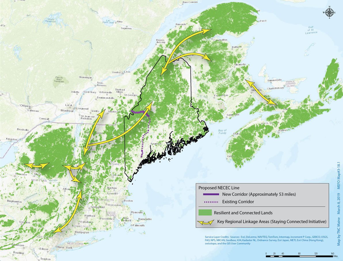
The first corridor would carry electricity from hydropower dams in Quebec to Massachusetts, cutting a 150-foot-wide swath across 53 wooded miles in western Maine before linking to established utility lines.
Perpendicular to that NECEC line is a corridor of concern to other species: a natural artery that flows along the spine of the Appalachian Mountain range from Georgia to Maine. The northern Appalachian region supports abundant wildlife in one of the world’s last intact temperate broadleaf forests.
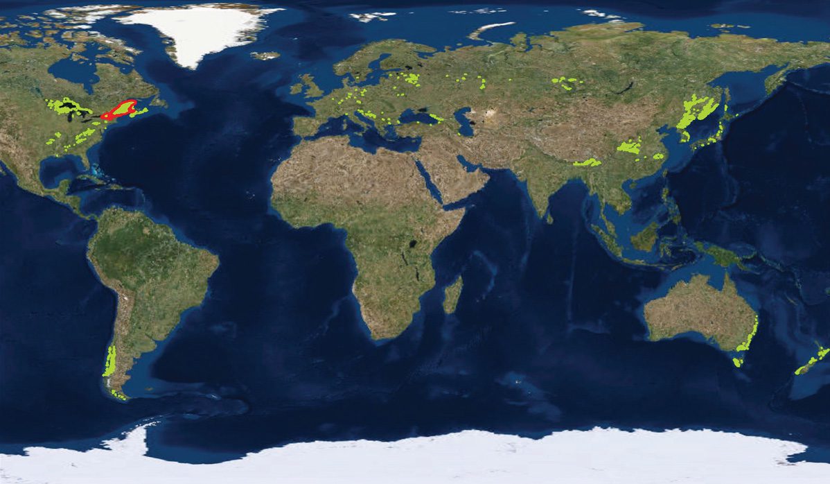
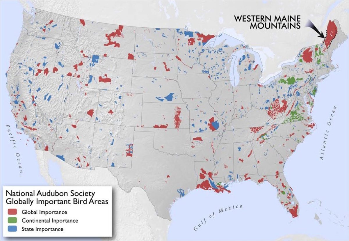
The mountains of western Maine are home to 139 rare plant and animal species (21 of them globally rare) and are the last bastion for wild brook trout in the eastern United States. The region’s significance for migrating neotropical birds along the Atlantic Flyway stretching from Canada to South America prompted the National Audubon Society to include it as part of the nation’s largest globally important bird area.
The northern Appalachian Mountains may draw even more species as plants and animals shift northward and up slopes to cope with a warming world – a dynamic depicted in The Nature Conservancy’s mesmerizing but disturbing Migrations in Motion map online. That movement is already underway; an analysis of 51 studies among five taxonomic groups (including mammals, birds and invertebrates) found shifts per decade of 6 to 11 meters upslope, and from 6 to nearly 17 kilometers northward.
Through widespread mapping work over the past decade, scientists have identified places with the geology, topography and soils that could best support diverse species as climate conditions change. A key buffering element, they discovered, is abundant microclimates, created by factors like topographical variation, orientation to the sun and proximity to water.
The western Maine mountains, it turns out, are a microclimate mecca. They rank among the most “resilient” landscapes in the eastern United States, meaning they’re more likely to sustain native plants and animals well into the future.
That resilience depends, in part, on maintaining interconnected habitats (that enable wildlife to move across the landscape) along the ecological thoroughfare running through western Maine up to the Canadian Maritimes and Gaspé Peninsula.
“Movement is the main way that individuals and ultimately entire populations respond to climate change,” notes Malcolm Hunter, a professor of conservation biology at the University of Maine. “Forest fragmentation that impedes movement would likely make Maine’s native flora and fauna more vulnerable to climate change.”
Hunter acknowledges this landscape is not the “pristine wilderness” that some claim, but he notes that many of the region’s logging roads – typically one-fifth the width of the proposed corridor – are “temporary features” that still allow wildlife to move amid a patchwork of different-aged forest stands.
A permanent transmission line spanning 53 miles in an area known for its habitat connectivity represents a markedly different level of impact, one without precedent in the region.
Clearcuts create an abrupt habitat transition with conditions that Hunter reports are typically warmer, windier and drier than the shady forest interior. The mix of plants and animals changes, and invasive species can take hold. Along a utility corridor, the edge is subject to herbicide applications, electromagnetic radiation and aircraft warning lights.
Ecologists have found that an “edge effect” can extend hundreds of feet into adjoining woods, and Hunter estimates that the proposed corridor could affect at least 5,000 forested acres (assuming an edge effect of just 330 feet).
Forest fragmentation can pose long-term risks to species already stressed by the demands of climate adaptation, explains Richard Houghton, a senior scientist with Woods Hole Research Center in Falmouth, Mass. He was among 25 co-authors of a piece published last year in the journal Nature, Ecology and Evolution, writing that large and “functionally intact” forest ecosystems “enable species to undertake adaptive responses, such as dispersal or retreating to refugia.”
Center founder George Woodwell underscores the importance that intact forests play in carbon storage, saying “we have to use the forests of the earth – all of them; Maine’s forests are an incredible resource – to the state, the country and the world – that is not to be nibbled away; Maine should preserve them vigorously.”
The dangers of fragmentation and reduced climate resilience in key forests – like the northern Appalachian corridor – prompted five New England governors and five Canadian premiers to sign a resolution in 2016 committing to work across borders to “restore and maintain ecological connectivity.” Maine’s former governor, Paul LePage, did not sign the resolution, but Gov. Janet Mills has expressed support for its goals.
Amanda Shearin, with the Maine Department of Inland Fisheries and Wildlife, serves on an international working group charged with advancing the resolution by 2020 in all 11 participating jurisdictions. She says it’s helping “open the conversation to consider ecological connectivity” in making decisions.
One such decision is fast approaching as members of Maine’s Public Utilities Commission, Department of Environmental Protection and Land Use Regulatory Commission weigh whether to let a high-voltage transmission corridor cleave one of the world’s last intact climate refuges.
Will they “preserve the integrity, stability and beauty” of its natural communities? By all enduring measures, that would be the right thing to do.
Resources:
• The Environmental Consequences of Forest Fragmentation in the Western Maine Mountains, an occasional paper produced by the Maine Mountain Collaborative and written by ecologist Janet McMahon (2018)
• Resilient and Connected Landscapes for Terrestrial Conservation, The Nature Conservancy (2016)
• DEP hearings on the NECEC corridor proposal will be held April 1-5, 2019 at the University of Maine, Farmington. Public hearings are scheduled for 6 p.m. on April 2 and April 4 in UMF’s Lincoln Auditorium.


