



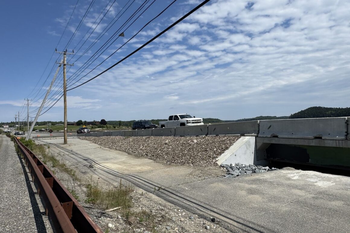
MACHIAS — Maine transportation officials are asking residents to weigh in on the future of the Machias Dike Bridge as the state launches a full federal environmental review of the long‑debated project.
Public comment is now open as the Maine Department of Transportation begins its environmental impact statement, or EIS — a federally required study of the project’s purpose, need and potential environmental impacts.
The agency plans to take feedback at a Sept. 30 public hearing in Machias and through an on‑demand virtual meeting available Sept. 23 through Oct. 31.
In March, the Upper Machias Bay Master Plan Leadership Committee voted 18-5, with one abstention, to recommend an in‑kind replacement of the dike. The EIS process, however, puts every alternative back on the table — including a bridge span — and requires MaineDOT to evaluate all reasonable options.
MaineDOT Deputy Commissioner Joyce Taylor said in a February telephone interview that the department is still open to alternatives for fixing the failing Machias dike, not just rebuilding it as it stands.
We don’t feel like we’ve closed the door completely,” she said. “I’ve worked at DOT for 25 years. This is the most complex project I’ve ever worked on.”
The preliminary alternatives under the EIS include taking no action, installing fully or partially gated replacement culverts or replacing the culverts with a bridge span.
Bridge #2246, the 92‑year‑old causeway structure, now carries a condition rating of 4 based on May and October 2023 inspections that found large spalls — chunks of concrete that have broken off — and heavy scaling, wide cracks, rotted timber members and settlement in the roadway.
The Federal Register notice for the project says its preliminary purpose is to bring the bridge’s condition rating up to “good” — a score of 7 or better on a 0‑to‑9 scale — and to preserve the Calais Branch Rail Corridor in accordance with the State Railroad Preservation Act.
A temporary bridge installed in April is expected to last 15 to 20 years, but will remain in place only until a permanent structure is built, according to MaineDOT Planning Manager Ian Gorecki.
According to the project schedule, the final combined EIS and record of decision are expected to be published in October 2027, with the U.S. Army Corps of Engineers permit anticipated in January 2028. That means work on a permanent fix for the Machias Dike Bridge may begin in 2028 — 19 years after the first public hearing on the project in 2009.
The EIS will follow the requirements of the National Environmental Policy Act and will be prepared in cooperation with the Federal Highway Administration, or FHWA.
“An EIS establishes the purpose and need for the project, considers input from the public and from state and federal agencies, identifies and evaluates all reasonable alternatives, and identifies a preferred alternative,” according to MaineDOT’s project website.
The project is classified as “major,” according to the FHWA’s notice of intent published in the Federal Register.
“MaineDOT invites the public to provide input on the purpose and need and range of alternatives to be considered, and to identify environmental impacts or issues related to the project,” the notice states.
Public comments must be received no later than Oct. 31, 2026, and can be submitted on the project page or emailed to [Show Email]. Comments can also be mailed to MaineDOT Environmental Office, 24 Child St., Augusta, ME 04330.
Wednesday’s public hearing is scheduled to begin at 6 p.m. at the Machias Memorial High School gymnasium at 1 Bulldog Lane.
Officials said a link to the on‑demand virtual public meeting will be available from Sept. 23 through Oct. 31 and will be posted on the MDOT project page when it goes live Sept. 23.
The Upper Machias Bay Master Plan Leadership Committee formed in January 2025 as a collaboration between the town of Machias and the Sunrise County Economic Council to address key issues, including downtown flooding, replacement of the Machias Dike Bridge and water quality.
The committee researched alternatives to an in‑kind replacement, including gated culverts — known as clappers — that control water flow.
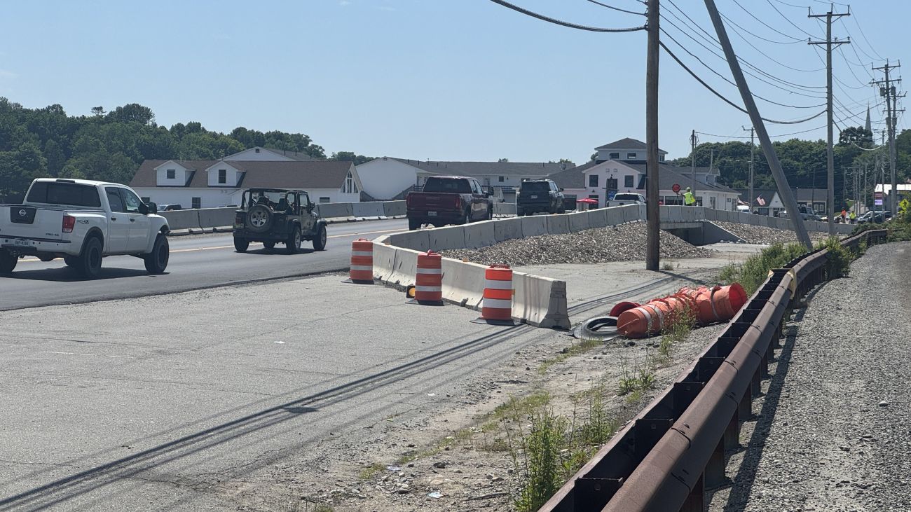
Taylor said MaineDOT would likely oppose replacing the bridge span, which is meant to let water back into the Middle River for fish passage and wetland restoration, because of concerns about flooding on nearby properties.
“We’re not going to take property or flood property against landowners’ will with transportation dollars,” she said.
The causeway was completed in 1868, two years after the Maine Legislature authorized the town of Machias to build a dike across the Middle River, replacing a private toll bridge that dated to 1835. It was enlarged for the Washington County Railroad in the 1890s. The current upstream structure was built in 1930 and widened in 1944.
The causeway now runs more than 1,000 feet, carrying Route 1, utility lines and the Downeast Sunrise Trail. Water moves through it via timber‑and‑stone box culverts, each fitted with a top‑hinged flap gate, or clappers, that let river water out to sea while blocking the tide from pushing back in. In effect, the road sits on top of a dam.
MaineDOT held its first public meeting on replacing the dike in 2009. After feasibility studies and surveys, the department announced in 2018 that in‑kind replacement was its preferred method.
Two years later, federal agencies, including the National Oceanic and Atmospheric Administration, pushed back, citing fish passage, rising sea levels and salt marsh restoration.
MaineDOT reversed course in 2022. Taylor, then the department’s chief engineer, told residents in June 2022 that replacing the dike with a similar structure was “no longer viable.”
After that, the department shifted its preferred alternative to a traditional bridge about 1,000 feet long, with a wide central span that would allow water to move freely in both directions.
Conservation groups, including the Downeast Salmon Federation, supported the bridge as a way to restore tidal flow and improve fish passage in the Middle River. However, the bridge would flood land upstream, turning much of it back into salt marsh and submerging hundreds of acres that residents of Machias and Marshfield have relied on for more than 150 years, according to previous reporting in The Maine Monitor.
MaineDOT reversed course again in the fall of 2023, choosing an in‑kind replacement after pressure from upstream landowners and vendors who sell their wares on the dike — everything from antiques to seafood.
As the debate dragged on, the structure kept deteriorating. Inspections that year found “increasing voids” — new areas of soil loss between the concrete slab under the road surface and the timber that forms the top of the gated boxes.
In November 2023, MDOT immediately closed portions of the dike on Route 1, including part of the shoulder and the parking area on the southbound side.
A temporary span went in that December. The crossing closed Dec. 4, the temporary bridge was placed Dec. 6 and the road reopened Dec. 15, according to reporting by the Machias Valley News Observer.
On Jan. 10, 2024, back-to-back storm surges flooded Machias in one of the most destructive storms to hit the Maine coast in decades. Salt water swirled around the Town Office, which sits nearly level with the Middle River, and more than a foot of seawater eventually surrounded the building.
Staff members relocated the next day to a pop‑up office farther inland by the Police Department at 17 Stackpole Drive.
“We never went back,” said Bill Kitchen, the Machias town manager at the time.
Downtown Machias faces flood risk from two directions: rising sea levels from the ocean and swelling river tributaries fueled by heavy rainfall, snowmelt and runoff. When both surge at once, floods like the 2024 100‑year event can strike quickly and unpredictably, leaving residents stranded and buildings damaged.
According to Ben Edwards, vice chair of the Machias Select Board and a member of the Upper Machias Bay Master Plan Leadership Committee, Machias has seen nine floods at the 100‑year level in the past seven years.
In November 2024, then‑MaineDOT Commissioner Bruce Van Note announced plans for a “longer‑term temporary bridge” that he said would pause the federal environmental review process.
In a letter to the towns of Machias and Marshfield, Van Note estimated the bridge would cost about $2 million in state funds, would be built in a way that avoids federal permits and a review under the National Environmental Policy Act, or NEPA, and would be completed in 2025.
The same month, the Federal Highway Administration determined that a full environmental impact statement was required. The National Marine Fisheries Service had warned in a June 2024 letter that the proposed project would cause “significant adverse impacts” to federally managed fish species and their habitat, after which FHWA told MaineDOT it could not proceed with a less rigorous environmental assessment. The more in‑depth review did not officially begin until June 1, 2026 — roughly 18 months later.
Gorecki, the MaineDOT planning manager, said the department used that time to design and install the temporary structure and to allow the Upper Machias Bay Master Plan process to play out.
“After the completion of the Upper Machias Bay Master Plan, MaineDOT chose to proceed with our EIS,” Gorecki said in an email to Monitor Local.
In April 2026, the department replaced the December 2023 temporary span with the longer‑term interim structure Van Note had described. The Route 1 crossing closed April 1 for the replacement work and reopened at the end of that month. Gorecki confirmed the current structure is the same one referenced in Van Note’s letter, anticipated to last 15 to 20 years, and that it will remain in place only until a permanent structure is completed.
A two‑year statutory clock on the EIS began July 15, 2026, when the notice of intent was published in the Federal Register. Under the forecasted schedule, the draft EIS is expected to be signed in April 2027, followed by a public meeting on the draft June 11, 2027.
The final combined EIS and Record of Decision are expected to be published in October 2027, with the U.S. Army Corps of Engineers permit expected in January 2028.
Taylor, the MaineDOT deputy commissioner, said she understands the urgency in replacing the integral roadway.
“This is Route 1. It’s a really critical road for that area,” Taylor said in the February interview. “We’ve worked on this more than a decade. The tide gates aren’t working. We feel like we need to get to an answer — something we can build and get out and get that bridge replaced.”
Questions about the project can be directed to Ian Gorecki, the project manager, at MaineDOT’s Bureau of Planning at 207‑592‑0312 or [Show Email].